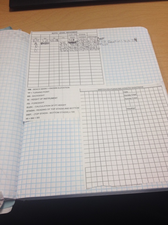
Activity 3.4.1 A Differential Leveling
In
this activity you will use a surveying technique called differential leveling
to establish the elevation of a horizontal plane of sight in order to determine
the elevation of various features in your classroom.
|
Conclusion
1. Why would a plane survey be unacceptable in order to lay out a pipeline from Alaska to the continental U.S.? A plane survey would be unacceptable in order to lay out a pipeline from Alaska to the US because the survey would be accurate over water. 2. In this activity we found the vertical position (elevation) of the points of interest. What information would be gained from a survey that provides vertical position? When would the determination of horizontal position be important in a construction project? A civil engineer would learn how tall/high the plane is it. Give some examples of the need for highly accurate location (vertical and/or horizontal) information during the design or construction of a civil engineering project. Bridges, Mountains, Valleys 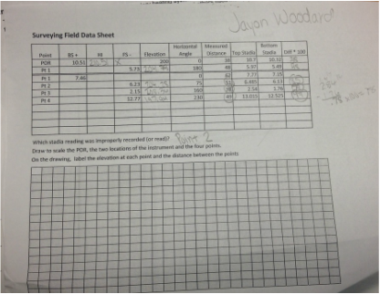
|
|
